| |

|
|
|
| |
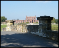
 Near to Ashburnham in East Sussex and Penhurst at Creep Wood is an old earthworks
probably dating from Pre-Saxon times, the site is about 250 metres
long .
Ashburnham is mentioned in the Domesday book, as being badly effected
by the Normans, who reduced its value from £6.00 prior to the invasion
to £1.00 after the invasion. Its value increased back to £9.00 by the
time of the Domesday survey, probably due to the Iron workings, and salt
workings on the Pevensey levels which would have been tidal at the time. Near to Ashburnham in East Sussex and Penhurst at Creep Wood is an old earthworks
probably dating from Pre-Saxon times, the site is about 250 metres
long .
Ashburnham is mentioned in the Domesday book, as being badly effected
by the Normans, who reduced its value from £6.00 prior to the invasion
to £1.00 after the invasion. Its value increased back to £9.00 by the
time of the Domesday survey, probably due to the Iron workings, and salt
workings on the Pevensey levels which would have been tidal at the time.
In the 12th century records show that Reginals de Oseburnham granted
lands in Ashburnham to the Abbey in Robertsbridge.
Ashburnham was controlled by the Ashburnham family from the 1100's until
1953, when Lady Catherine Asburnham died.
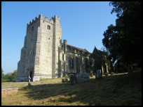
In 1649 king Charles I was executed, and some gruesome souveniers were
brought back to the church, which were believed to have healing properties.
These consisted of the shirt, silk drawers, and garters which he wore
when executed, together with his watch, a lock of his hair, and the sheet
thrown over the body. The items were brought back by John Ashburnham,
the King's Groom of the Bedchamber, who was also the MP for Hastings .
The Iron blast furnace and forge were owned by the Crowley family at Ashburnham the
furnace which was the last one in Sussex to be extinguished in 1813, and its forge
which closed 1826.
In the graveyard are a number of examples of Harmer terracotta embossed
grave stones, dating from the early 1800's. |
|
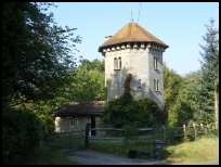
 The Ashbourne valley is very pretty, and the Tower House is unusual,
but very hard to find. The Ashbourne valley is very pretty, and the Tower House is unusual,
but very hard to find.
The area around is full of small lanes, steep hills and small
rivers. |
|
 The parish of Ashburnham in East Sussex spreads for quite a distance towards
Brown Bread Street , and has very few amenities. The parish of Ashburnham in East Sussex spreads for quite a distance towards
Brown Bread Street , and has very few amenities.
The nearest town is Battle about 6 miles to the east, with many
shops, and the main line station from Hastings to London.
Busses can be caught at Brightling , Ninfield or Battle , but it
is unlikely you would live around this area without a car. |
|
| Ashburnham is shown as the red symbol on the map. |
|
|
Nearby Villages
(click on symbol to see the village page) |
| Village= | |
Town= | |
Recorded in Domesday= |  |
| |
|
|
Battle |
(William the Conqueror prevails) | | 4.05 miles |
|
|
Bodle Street |
(White Horse on the roof) | | 2.21 miles |
|
|
Boreham Street |
(Picturesque village on top of the Ridge) | | 2.49 miles |
|
|
Brightling |
(famous for Mad Jack Fuller) | | 3.82 miles |
|
|
Cade Street |
(Jack Cade and the Kentish rebellion) | | 6.20 miles |
|
|
Catsfield |
(Iron, Railways and Clocks) | | 2.70 miles |
|
|
Cripps Corner |
(Home Guard surprises the Army) | | 7.01 miles |
|
|
Crowhurst |
(Village devastated by the Normans) | | 5.04 miles |
|
|
Dallington |
(Custers Last Stand!) | | 3.04 miles |
|
|
Hailsham |
(Ropes and Napoleon) | | 6.76 miles |
|
|
Heathfield |
(19th Century Natural Gas) | | 7.17 miles |
|
|
Hellingly |
(Only remaining Ciric in Sussex) | | 6.53 miles |
|
|
Herstmonceux |
(Castle and Observatory) | | 3.36 miles |
|
|
Hooe |
(The Haunt of Smugglers) | | 2.81 miles |
|
|
Horam |
(Which Station do we get off at ?) | | 6.74 miles |
|
|
Mountfield |
(17th Century Coal !!) | | 5.05 miles |
|
|
Netherfield |
(Village at the top of the Hill) | | 2.91 miles |
|
|
Ninfield |
(Last of the Iron Stocks) | | 2.19 miles |
|
|
Penhurst |
(Beautiful yet Remote) | | 1.20 miles |
|
|
Punnetts Town |
(The Windmill on the Hill) | | 4.75 miles |
|
|
Rushlake Green |
(Open Village and Nuclear Bunker) | | 4.09 miles |
|
|
Sedlescombe |
(Best gunpowder in Europe) | | 6.44 miles |
|
|
Vines Cross |
(Cannons and Doodlebugs) | | 5.84 miles |
|
|
Warbleton |
(The Iron Man) | | 5.06 miles |
|
|
Wartling |
(World War II defence centre) | | 3.78 miles |
|
|
Whatlington |
(King Harold's Manor) | | 5.44 miles |
|
|
Windmill Hill |
(Largest Post Mill in Sussex) | | 2.78 miles |
|
|
| Copyright Villagenet 1998-2025 | |
| |
|
|
Local Interest
Just click an image |
|
|
|
|
|
|
|
|
|
|
|
|
|
|
| |