| |

|
|
|
| |
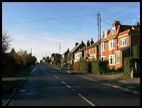
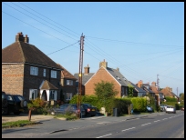
 Broad Oak in East Sussex is located on the old Ridgeway, which is
now the A265, about 2 miles to the East of the
market town of Heathfield . Broad Oak in East Sussex is located on the old Ridgeway, which is
now the A265, about 2 miles to the East of the
market town of Heathfield .
In the 1816 the most important house in the village
was taken on lease by John Francis. He set up a boarding
school named the 'Broad Oak Academy'. It had about 60
day scholars and 40 boarders, most were children of
prosperous tradesmen and farmers.
Unfortunately an outbreak of smallpox among the children in 1829,
caused the Academy to be closed down, and Mr Francis
moved over the county border to Cranbrook . Prior to
his departure he issued a curious handbill, defending
himself against charges of negligence and concealment
which had been spread around. It was printed in a
variety of type faces, and began
'Mr Francis ..... has deeply to lament, that after
a residence in Broad Oak for about 13 years, there
should be found one capable of endeavouring to
conceal such a dreadful disease in his house, and
thereby expose his neighbours and nearly a hundred
children under his tuition to its direful contagion.'
One of Broad Oaks more famous villagers was Frank
Bruno the boxer, who was resident in the village
when he was a child. |
|
 Just before you enter the village from the East, look
to your left, towards Cade Street , across the
Heathfield horse racing turf. Just before you enter the village from the East, look
to your left, towards Cade Street , across the
Heathfield horse racing turf.
Again, coming into the village from the east, turn
right down the hill towards Mayfield . The view across
the valley towards Wadhurst is quite spectacular. |
|
 Broad Oak in East Sussex has few services, and most that are needed
can be found in the local town of Heathfield . Broad Oak in East Sussex has few services, and most that are needed
can be found in the local town of Heathfield .
The Hawkhurst to Heathfield bus route travels
through the village.
The nearest trains can be caught at Stonegate about
7 miles north east.
The nearest major shopping areas are Hastings about
15 miles south east, Tunbridge Wells about 13
miles north and Eastbourne approx 13 miles south. |
|
| Broad Oak is shown as the red symbol on the map. |
|
|
Nearby Villages
(click on symbol to see the village page) |
| Village= | |
Town= | |
Recorded in Domesday= |  |
| |
|
|
Blackboys |
(Charcoal and Soot) | | 6.12 miles |
|
|
Brightling |
(famous for Mad Jack Fuller) | | 5.01 miles |
|
|
Burwash |
(The home of Rudyard Kipling) | | 4.68 miles |
|
|
Burwash Common |
(Roughest pub in the South East) | | 2.43 miles |
|
|
Burwash Weald |
(Roughest pub in the South East) | | 2.86 miles |
|
|
Buxted |
(The first Iron Cannon in England) | | 6.81 miles |
|
|
Cade Street |
(Jack Cade and the Kentish rebellion) | | 0.78 miles |
|
|
Cross in Hand |
(The Crusaders Assembly) | | 2.78 miles |
|
|
Dallington |
(Custers Last Stand!) | | 3.76 miles |
|
|
East Hoathly |
(Another Sussex Cannibal?) | | 6.41 miles |
|
|
Etchingham |
(The oldest Brass Weather Vane in the country) | | 7.01 miles |
|
|
Five Ashes |
(Vast collection of rock plants) | | 3.42 miles |
|
|
Hadlow Down |
(Wealden Cannons and Charcoal) | | 4.66 miles |
|
|
Halland |
(Ancient Slaughter) | | 7.41 miles |
|
|
Heathfield |
(19th Century Natural Gas) | | 1.53 miles |
|
|
Horam |
(Which Station do we get off at ?) | | 3.61 miles |
|
|
Mayfield |
(Saint Dunstan and the Devil) | | 3.17 miles |
|
|
Netherfield |
(Village at the top of the Hill) | | 6.84 miles |
|
|
Penhurst |
(Beautiful yet Remote) | | 6.59 miles |
|
|
Punnetts Town |
(The Windmill on the Hill) | | 1.90 miles |
|
|
Rushlake Green |
(Open Village and Nuclear Bunker) | | 2.74 miles |
|
|
Stonegate |
(Ancient Roman Cross Road) | | 5.51 miles |
|
|
Vines Cross |
(Cannons and Doodlebugs) | | 2.93 miles |
|
|
Waldron |
(Fullers Earth) | | 4.01 miles |
|
|
Warbleton |
(The Iron Man) | | 2.56 miles |
|
|
| Copyright Villagenet 1998-2025 | |
| |
|
|
Local Interest
Just click an image |
|
|
|
|
|
|
|
|
|
|
|
|
|
|
| |