blank

Cripps Corner in East Sussex

Google map showing area surrounding Cripps Corner
(Home Guard surprises the Army)
Location: 50.962253,0.528368
General Details
Cripps Corner SussexCripps Corner in East Sussex lies about 4 miles north east of Battle , on an the site of an old Roman garrison, which was used to guard and control the road connecting Whatling Street (Rochester) to the ports at Bodiam , Sedlescombe and Westfield .

The area was used for iron production by the Romans , and nearby are many bloomeries(iron smelters), which sent the iron ingots(blooms) to the local ports for shipping to Londinium. After the Norman conquest the land was given to the Count of Eu, and was included in the Hundred of Staple (see Staplecross ). The land was gifted to Robertsbridge Abbey in the 12th century by Alicia, widow of the 4th Count of Eu.

The Abbot of Robertsbridge Abbey in 1332 was Walter Krips, and it believed that Cripps Corner is derived from his name.

Cripps Corner was also the site of the Gallowes of Whoorne, which was still in use for execution of smugglers and highwaymen until the 17th century.

In the early part of the 20th century, a wheelwright named Tedham lived here. He was also the village undertaker, however his speciality was the manufacture of the big Sussex Farm Wagons. One of them - with his trade plate on it may be seen at Michelham Priory.

In September 1941, the Ticehurst Home Guard were on manoeuvers in the Cripps Corner area, with the local pub the White Hart as their target. After disembarking from Warrens Coach, in a wooded area, they marched south and eventually crept through the hedges and ditches up to the road in front of the pub. Here they let off a volley at the army defenders - much to their surprise - as the operation was supposed to have finished an hour earlier! The story ends on a high note as the publican opened the bar to allow the gallant Home Guard to quench their thirst.

(We are grateful to the landlord of the White Hart for providing some of this information)

Views
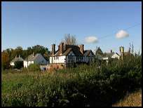
Cripps Corner East SussexCripps Corner in East Sussex has some nice South facing views, which can be seen from the vicinity of the Public House.

In this area are a number of vinyards, which are worth investigating.
Services
Cripps Corner East SussexCripps Corner in East Sussex has a small number of businesses.

The Hawkhurst to Hastings bus service travels through the village providing an infrequent service.

The nearest shopping centre is in Battle about 4 miles south west. The major centre of Hastings lies about 7 miles south.

The London to Hastings train service is available from Robertsbridge about 5 miles north west, and Battle 4 miles south west.
Map
Cripps Corner is shown as the red symbol on the map.

Nearby Villages

(click on symbol to see the village page)
Village= Town= Recorded in Domesday=
Ashburnham (Last Iron Furnace in Sussex)
7.01 miles
Battle (William the Conqueror prevails)3.68 miles
Beckley (Alfred the Great and Guns !)
5.14 miles
Bodiam (The finest ruined castle in the Country)
2.90 miles
Brede (Edward I inspects the Channel Fleet)3.51 miles
Brightling (famous for Mad Jack Fuller)
5.66 miles
Broad Oak Brede (On the Crossroads)3.17 miles
Burwash (The home of Rudyard Kipling)6.63 miles
Etchingham (The oldest Brass Weather Vane in the country)5.09 miles
Ewhurst Green (Great Fire of London contributions)2.39 miles
Hurst Green (The Youngest Highwayman on record)4.65 miles
Icklesham (Paul McCartney's Recording Studio)7.01 miles
Mountfield (17th Century Coal !!)
2.16 miles
Netherfield (Village at the top of the Hill)
4.41 miles
Newenden (Alfred the Great's Fort)
5.26 miles
Northiam (Prime Ministers D Day inspection)3.85 miles
Peasmarsh (Black Death moves village)6.64 miles
Penhurst (Beautiful yet Remote)
5.90 miles
Robertsbridge (The Home of Modern Cricket)2.92 miles
Salehurst (Richard the Lion Heart's Gift)
2.64 miles
Sedlescombe (Best gunpowder in Europe)
2.01 miles
Staplecross (Mothers grudge hangs son)0.86 miles
Udimore (Angels move the Church)
5.49 miles
Westfield (Bonfire Boys under suspicion)
4.27 miles
Whatlington (King Harold's Manor)
1.87 miles
Copyright Villagenet 1998-2024
 
Local Interest
Just click an image
The Rudes as lots of people call us, are an outdoor touring theatre company specialising in taking new & original theatre to mainly small rural communities and a few towns across the South of England. We were founded in 1998 & first toured in the Summer of 1999. Currently we tour only in the summer performing 50+ times nightly during June, July & August. https://therudemechanicaltheatre.co.uk
Winchelsea Museum
Roman, Saxon and Norman History of the South East
Hastings Area Archaeological Research Group
Rye Museum
Sigi
World War 2 Vehicle database
Wealden Iron Research Group
Battle Museum of Local History
(Hard to find but worth the Visit)
Talk in Code fabulous new Album
Battle and District Historical Society
For all things mosaic, commissions workshops etc please contact Hannah