| |

|
|
|
| |
 Crowhurst in East Sussex lies on a back road between Battle and Hastings. Crowhurst in East Sussex lies on a back road between Battle and Hastings.
The village is first mentioned in 771 as Croghyrst, when King
Offa of Mercia, gave the Bishop of Selsey 8 hides (a measurement
of area) within the village. In return, the Bishop built a
church for the population.
Before 1066 the manor was owned by King Harold , and was
completely destroyed by the Normans before the Battle of
Hastings. After the conquest the land was given to Robert
Count of Eu.
After the conquest, the manor was owned by the Fitz-Lambert
family who were the landowners til the late 1200's, when
Walter de Scotney came to control it. De Scotney was one
of the knights who accompanied Richard I on his 3rd crusade .
On returning from the Crusade , Walter was accused of
trying to poison his employer the Earl of Gloucester and was
found guilty and executed in 1259 at Winchester, and the
land reverted to the monarchy.
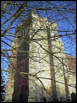
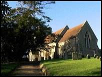
To the south of the church is the old ruined manor house
built by Walter de Scotney in the 12th century, it looks
small now, but was probably a major undertaking at the
time.
In 1378 200 oak trees from Crowhurst were felled to repair
the fortifications in Rye , which had been damaged by the
French who had burned the town to the ground during
the Hundred Years War .
In 1412, Henry IV gave Sir John Pelham the manor, who
subsequently built the present parish church.
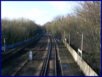
In 1902, a giant viaduct was built across the Crowhurst
marshes to Bexhill. This four mile stretch of track was
to enable Bexhill to link to Charing Cross via the London
Hastings line. This branch line was closed by Dr Beeching
in 1964, and the viaduct was demolished in 1969. |
|
 To the south of the church is the old ruined manor house
built by Walter de Scotney in the 12th century.
Crowhurst in East Sussex is quite an isolated community, and has many
attractive rural views. To the south of the church is the old ruined manor house
built by Walter de Scotney in the 12th century.
Crowhurst in East Sussex is quite an isolated community, and has many
attractive rural views. |
|
 The village has few services, with only the main line train
service to London providing convenient access to the capital. The village has few services, with only the main line train
service to London providing convenient access to the capital.
The nearest shopping is at nearby Battle about 4 miles north,
or Bexhill about 4 miles south with its main shopping centre. |
|
| Crowhurst is shown as the red symbol on the map. |
|
|
Nearby Villages
(click on symbol to see the village page) |
| Village= | |
Town= | |
Recorded in Domesday= |  |
| |
|
|
Ashburnham |
(Last Iron Furnace in Sussex) | | 5.04 miles |
|
|
Battle |
(William the Conqueror prevails) | | 2.52 miles |
|
|
Boreham Street |
(Picturesque village on top of the Ridge) | | 5.81 miles |
|
|
Brede |
(Edward I inspects the Channel Fleet) | | 5.70 miles |
|
|
Catsfield |
(Iron, Railways and Clocks) | | 2.37 miles |
|
|
Guestling |
(Changing guards at Buckingham Palace) | | 5.94 miles |
|
|
Hastings Bulverhythe |
(Landing place of the citizens) | | 2.49 miles |
|
|
Hastings East Cliff |
(Beautiful Views and peaceful Walks) | | 5.17 miles |
|
|
Hastings Old Town |
(The ancient Cinque Port) | | 4.40 miles |
|
|
Hastings Ore |
(Iron and the Turnpike) | | 4.87 miles |
|
|
Hastings Sea Front |
(Modern amusements,pier and promenade) | | 2.86 miles |
|
|
St Leonards on Sea |
(an Edwardian family's gentile resort) | | 2.99 miles |
|
|
Hooe |
(The Haunt of Smugglers) | | 4.25 miles |
|
|
Ninfield |
(Last of the Iron Stocks) | | 3.23 miles |
|
|
Normans Bay |
(Last Invasion in 1066) | | 6.04 miles |
|
|
Penhurst |
(Beautiful yet Remote) | | 4.83 miles |
|
|
Sedlescombe |
(Best gunpowder in Europe) | | 3.87 miles |
|
|
Wartling |
(World War II defence centre) | | 6.52 miles |
|
|
Westfield |
(Bonfire Boys under suspicion) | | 3.68 miles |
|
|
Whatlington |
(King Harold's Manor) | | 3.95 miles |
|
|
| Copyright Villagenet 1998-2025 | |
| |
|
|
Local Interest
Just click an image |
|
|
|
|
|
|
|
|
|
|
|
|
|
|
| |