| |

|
|
|
| |
 Icklesham in East Sussex is located about 6 miles to the east of Hastings, on
the main A259 Hastings to Rye road. Icklesham in East Sussex is located about 6 miles to the east of Hastings, on
the main A259 Hastings to Rye road.
In 1282 the King's treasurer had been sent to Old Winchelsea to
investigate the danger to the town from the sea, the report was
to abandon the town and create a new town on the heights of
Petit Ihamme nowadays Icklesham .
Icklesham was one of the few villages recording evacuation plans
in the event of the feared invasion of Napoleon. In 1798 precise
livestock records were made, and everyone give instructions on
where they were supposed to go. Captain Lamb of the Yeomanry and
Provisional Cavalry in Sussex was to be in charge. (See also
the Peasmarsh pages.)
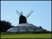
On Hogs Hill stands the old smock windmill, it has been restored,
and in the last quarter of the 20th century it has found a new
use as the recording studios of Sir Paul McCartney. |
|
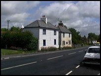
 Icklesham in East Sussex is on the main A259 which runs along the ridge between
the coast and the river Brede . Icklesham in East Sussex is on the main A259 which runs along the ridge between
the coast and the river Brede .
From the main road, looking south you can see the hills at Fairlight ,
and if you carry on throught the village towards Rye, to your left
is the Brede valley.
If you travel up to the windmill, the view to the sea is stunning,
and the back road going east takes you through to one of the old Medieval
gates into Winchelsea . The 1066 Country Walk runs through the village. |
|
 Icklesham in East Sussex is a small village with a few shops and public houses. Icklesham in East Sussex is a small village with a few shops and public houses.
The Hastings to Rye hourly bus passes through the village.
The nearest station is at Doleham Halt near Guestling , or at
Winchelsea both on the Ashford to Hastings line, which has an
hourly service. |
|
| Icklesham is shown as the red symbol on the map. |
|
|
Nearby Villages
(click on symbol to see the village page) |
| Village= | |
Town= | |
Recorded in Domesday= |  |
| |
|
|
Brede |
(Edward I inspects the Channel Fleet) | | 3.51 miles |
|
|
Broad Oak Brede |
(On the Crossroads) | | 3.92 miles |
|
|
Broomhill |
(Swept away by the Storm) | | 6.32 miles |
|
|
Camber |
(Sands and Holidays) | | 5.58 miles |
|
|
Cripps Corner |
(Home Guard surprises the Army) | | 7.01 miles |
|
|
East Guldeford |
(Barn-like Church) | | 4.66 miles |
|
|
Fairlight |
(Firehills and Views) | | 2.82 miles |
|
|
Guestling |
(Changing guards at Buckingham Palace) | | 2.06 miles |
|
|
Hastings East Cliff |
(Beautiful Views and peaceful Walks) | | 4.26 miles |
|
|
Hastings Ore |
(Iron and the Turnpike) | | 4.31 miles |
|
|
Old Winchelsea |
(Abandoned after the Great Storm) | | 2.41 miles |
|
|
Pett |
(End of the Royal Military Canal) | | 1.57 miles |
|
|
Playden |
(Saltcote and fish) | | 5.13 miles |
|
|
Rye |
(On the Island) | | 3.64 miles |
|
|
Rye Harbour |
(Nature Reserve and unspoilt beaches) | | 4.22 miles |
|
|
Sedlescombe |
(Best gunpowder in Europe) | | 6.13 miles |
|
|
Staplecross |
(Mothers grudge hangs son) | | 7.10 miles |
|
|
Udimore |
(Angels move the Church) | | 1.97 miles |
|
|
Westfield |
(Bonfire Boys under suspicion) | | 4.38 miles |
|
|
Winchelsea |
(Inland Cinque Port !!) | | 1.74 miles |
|
|
Winchelsea Beach |
(Holidaymakers and Henry VIIIs Fort) | | 2.27 miles |
|
|
| Copyright Villagenet 1998-2025 | |
| |
|
|
Local Interest
Just click an image |
|
|
|
|
|
|
|
|
|
|
|
|
|
|
| |