| |

|
|
|
| |
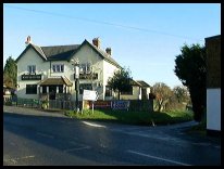
 Mark Cross in East Sussex is a small village sitting on the junction of the
Tunbridge Wells to Mayfield and Wadhurst to Crowborough main roads. Mark Cross in East Sussex is a small village sitting on the junction of the
Tunbridge Wells to Mayfield and Wadhurst to Crowborough main roads.
The area was settled in the Iron-Age when Saxonbury Camp was built with its
defensive ditch , to the north of the village.
In 1375 a number of men from Frant were reported to have broken into
the Archbishop of Canterbury's Estate of Frankham, where they took deer
wounded others with arrows and badly injured the park keeper and his men.
A somewhat eccentric local yeoman called Bridger used
to live here. He was very tall, with fiery red hair
plaited into a pigtail, which he kept tied halfway
down his back with a white satin ribbon. He took
little trouble with his appearance, but he was
generous and kindly man. He owned a large estate with
a lodge that he allowed tramps to sleep in.
Once a local policeman(who must have been a newcomer to the
district), saw a ragged man crouched over a fire of
sticks near the lodge, he took him into custody, and
marched him off to Mark Cross , where the magistrates
were sitting. To their great surprise, the offender
was found to be none other than Bridger himself.
Rearing himself up to his full height, he told the
policeman, 'I'll trouble you not to come interfering
on MY land in future' |
|
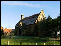
 Mark Cross in East Sussex has some spectacular views across the Sussex
countryside, the best can be seen from the steps of the
village church facing west towards Crowborough . Mark Cross in East Sussex has some spectacular views across the Sussex
countryside, the best can be seen from the steps of the
village church facing west towards Crowborough .
There are some pretty views to the South East, from
the crossroads. |
|
 Mark Cross in East Sussex has limited services. Mark Cross in East Sussex has limited services.
The nearest major town is Tunbridge Wells about 6
miles to the north. The nearest small town is
Crowborough about 6 miles west.
The nearest train services run from Wadhurst about 3 miles east. |
|
| Mark Cross is shown as the red symbol on the map. |
|
|
Nearby Villages
(click on symbol to see the village page) |
| Village= | |
Town= | |
Recorded in Domesday= |  |
| |
|
|
Bells Yew Green |
(The ruins of Bayham Abbey) | | 3.34 miles |
|
|
Crowborough |
(The home of Sir Arthur Conan Doyle) | | 4.04 miles |
|
|
Eridge Green |
(The home of the Neville Family) | | 3.04 miles |
|
|
Five Ashes |
(Vast collection of rock plants) | | 4.36 miles |
|
|
Frant |
(King Johns hunting lodge) | | 2.51 miles |
|
|
Groombridge |
(Home of the Groombridge Gang) | | 4.81 miles |
|
|
Hartfield |
(A.A.Milne and Winnie-the-Pooh) | | 7.03 miles |
|
|
Lamberhurst |
(Scotney Castle and Gardens) | | 6.44 miles |
|
|
Mayfield |
(Saint Dunstan and the Devil) | | 2.80 miles |
|
|
Rotherfield |
(Source of the rivers Rother and Uck) | | 1.99 miles |
|
|
Stonegate |
(Ancient Roman Cross Road) | | 5.56 miles |
|
|
Ticehurst |
(Anne Boleyn and Pashley Manor) | | 6.66 miles |
|
|
Wadhurst |
(Last bare fisted Prize-Fight in England) | | 3.48 miles |
|
|
Withyham |
(De La Warrs and Sackvilles) | | 6.09 miles |
|
|
| Copyright Villagenet 1998-2025 | |
| |
|
|
Local Interest
Just click an image |
|
|
|
|
|
|
|
|
|
|
|
|
|
|
| |