| |

|
|
|
| |
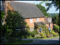
 Warbleton in East Sussex lies about 2 1/2 miles south east of Heathfield and south of
Punnetts Town . It is a small village in a very quiet and unspoilt part
of East Sussex. Warbleton in East Sussex lies about 2 1/2 miles south east of Heathfield and south of
Punnetts Town . It is a small village in a very quiet and unspoilt part
of East Sussex.
From the 1540's to the late 1700's the area near to Warbleton was in
the heart of the Sussex Iron industry, with Cralle furnace creating
cannons and other implements. The finished goods were sent by river
to the sea at Pevensey for export.
During the reign of Queen Mary (1553 - 1558) the Ironmaster Richard
Woodman, who was also a churchwarden, publicly objected to the local
Parish Priest changing from Protestant to Roman Catholic, as the
queen had instructed. He was captured, and taken to London to stand
trial. At his trial he showed remarkable knowledge of the Bible, and
was able to quote from it verbatim. He was condemned by the Bishop of
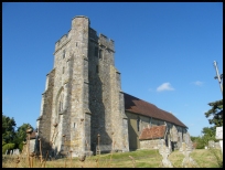
Winchester, and it is believed that he was locked in Warbleton Church
Tower. On June 22nd 1557, he was burned to death with nine other
martyrs in front of the Star Inn at Lewes.
A local legend claims that the village public house called the
Warbill-in-tun was named because a thirsty soldier opened a
tun (barrel) of beer with his War Bill(a Halberd).
During the early 1800's two of the tombstones in the churchyard
were decorated with Harmer terracotta plaques, these were made
by Jonathan Harmer who was a stonemason from Heathfield . |
|
 Warbleton in East Sussex is on the top of a hill, and has views all round from the
churchyard.
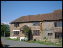
Going down from the church towards the old Furnace, the Public House
and one other building are all that is within the village. Warbleton in East Sussex is on the top of a hill, and has views all round from the
churchyard.
Going down from the church towards the old Furnace, the Public House
and one other building are all that is within the village.
The South Downs can be seen in all their magnificence from the church. |
|
 The church and Public House are the only services in the village,
Heathfield is the nearest market town, with Eastbourne the nearest
major shopping centre lying about 10 miles to the South East. The church and Public House are the only services in the village,
Heathfield is the nearest market town, with Eastbourne the nearest
major shopping centre lying about 10 miles to the South East.
The nearest trains are at Wadhurst about 10 miles north for the London
to Hastings service, and Eastbourne for the Hastings , or Brighton services. |
|
| Warbleton is shown as the red symbol on the map. |
|
|
Nearby Villages
(click on symbol to see the village page) |
| Village= | |
Town= | |
Recorded in Domesday= |  |
| |
|
|
Ashburnham |
(Last Iron Furnace in Sussex) | | 5.06 miles |
|
|
Blackboys |
(Charcoal and Soot) | | 6.21 miles |
|
|
Bodle Street |
(White Horse on the roof) | | 3.02 miles |
|
|
Brightling |
(famous for Mad Jack Fuller) | | 5.11 miles |
|
|
Broad Oak |
(Smallpox at the Academy) | | 2.56 miles |
|
|
Burwash Common |
(Roughest pub in the South East) | | 3.81 miles |
|
|
Burwash Weald |
(Roughest pub in the South East) | | 4.12 miles |
|
|
Cade Street |
(Jack Cade and the Kentish rebellion) | | 1.81 miles |
|
|
Chiddingly |
(Walking on Cheese ??) | | 4.71 miles |
|
|
Cross in Hand |
(The Crusaders Assembly) | | 3.62 miles |
|
|
Dallington |
(Custers Last Stand!) | | 3.07 miles |
|
|
East Hoathly |
(Another Sussex Cannibal?) | | 5.47 miles |
|
|
Hadlow Down |
(Wealden Cannons and Charcoal) | | 5.94 miles |
|
|
Halland |
(Ancient Slaughter) | | 6.72 miles |
|
|
Heathfield |
(19th Century Natural Gas) | | 2.27 miles |
|
|
Hellingly |
(Only remaining Ciric in Sussex) | | 4.05 miles |
|
|
Herstmonceux |
(Castle and Observatory) | | 3.88 miles |
|
|
Horam |
(Which Station do we get off at ?) | | 2.03 miles |
|
|
Laughton |
(Knight captures King of France) | | 7.34 miles |
|
|
Netherfield |
(Village at the top of the Hill) | | 6.32 miles |
|
|
Ninfield |
(Last of the Iron Stocks) | | 7.14 miles |
|
|
Penhurst |
(Beautiful yet Remote) | | 5.45 miles |
|
|
Punnetts Town |
(The Windmill on the Hill) | | 1.94 miles |
|
|
Rushlake Green |
(Open Village and Nuclear Bunker) | | 1.19 miles |
|
|
Vines Cross |
(Cannons and Doodlebugs) | | 0.98 miles |
|
|
Waldron |
(Fullers Earth) | | 3.75 miles |
|
|
Windmill Hill |
(Largest Post Mill in Sussex) | | 4.52 miles |
|
|
| Copyright Villagenet 1998-2025 | |
| |
|
|
Local Interest
Just click an image |
|
|
|
|
|
|
|
|
|
|
|
|
|
|
| |