| |

|
|
|
| |
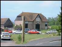
 Eridge Green in East Sussex is a small village on the Crowborough to Tunbridge Wells road. Eridge Green in East Sussex is a small village on the Crowborough to Tunbridge Wells road.
It was until this century, the home of the workers from Eridge Park.
The area was settled in the Iron-Age when Saxonbury Camp was built with its
defensive ditch , to the south east of the village near Mark Cross .
The village is closely tied with the Neville family who arrived in England
with William the Conqueror and settled at Eridge Park . Their decendants the
Abergavenny family together with their monogram are found on many of the
properties in this village and others in thge area such as Frant and
Rotherfield. The same monogram is found in Abergavenny in Wales ,
showing the influence of this family. ( The monogram is of a
large letter A, a bull, a Tudor Rose and a portcullis )
Eridge had a forge which was established before the 1500's but until
1550 it only produced wrought iron implements. The Neville family
invested a great deal in this forge, providing mill ponds to give
a regular supply of water. After 1550 the forge was producing
cannons for the Nevilles . Near the station was another furnace which
was known as Hamsell furnace but which went bankrupt in 1708 ending
150 years of service.
In the 1573 Queen Elizabeth I stayed in the Eridge Park hunting lodge
for 6 days on her journey through Kent and Sussex in which she visited
many local influencial families.
In 1792 the second Earl of Abergavenny converted the old house
into a gothic Castle , which was renamed Eridge Castle , this became
the Abergavenny family's primary residence.
During the Napoleonic era, a military camp was to be found nearby
towards Groombridge , and in 1793 eighteen soldiers died from
smallpox and were buried in Frant churchyard. The present stone
buildings all around the area date from the late 1800's when all
the wooden buildings were rebuilt to please the eye of the Abergavennys.
The area was affected by the Swing riots in the autumn of 1830 with the
land workers demanding reasonable wages, these were put down forceably
by army on 15th November. A number of local workers were imprisoned or
transported to the colonies.
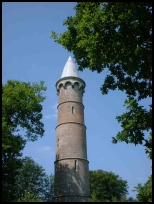
In 1838 a folly was built by the Abergavenneys on the top of Saxonbury
Hill and is a round tower with arrow slits.
In the mid 1800's the train line from Lewes to London was opened and passed
through Eridge Station , which lies about 1 mile to the south of the village
in a very pretty valley.
Eridge Castle was demolished just before the Second World War by Lord
Abergavenny and a modern house built, when the name reverted to Eridge Park. |
|
 Eridge Green in East Sussex is on the brow of a hill and has many beautiful
open views especially towards Crowborough .
Eridge Park is beautiful with many walks throughout the area. Eridge Green in East Sussex is on the brow of a hill and has many beautiful
open views especially towards Crowborough .
Eridge Park is beautiful with many walks throughout the area.
The area near the station is very pretty, especially if you
travel towards Groombridge .
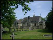
If you take the back road which goes next to the church, you come
to some very pretty woodland with rocky outcrops. |
|
 Eridge Green in East Sussex has a public house but no other services. Eridge Green in East Sussex has a public house but no other services.
The station was built in the mid 1800's and is at the bottom of the
hill on the Crowborough road . It has regular trains running to Uckfield
to the south and to London to the north.
The nearest shopping centres are at Crowborough to the south and
Royal Tunbridge Wells to the north. |
|
| Eridge Green is shown as the red symbol on the map. |
|
|
Nearby Villages
(click on symbol to see the village page) |
| Village= | |
Town= | |
Recorded in Domesday= |  |
| |
|
|
Ashurst |
(Miraculous Carving) | | 3.65 miles |
|
|
Bells Yew Green |
(The ruins of Bayham Abbey) | | 3.24 miles |
|
|
Blackham |
(Roughs and Prize Fighters) | | 4.28 miles |
|
|
Colemans Hatch |
(Church on the edge of the forest) | | 6.81 miles |
|
|
Crowborough |
(The home of Sir Arthur Conan Doyle) | | 3.63 miles |
|
|
Fordcombe |
(Paper Mill and the Field Marshal) | | 3.45 miles |
|
|
Frant |
(King Johns hunting lodge) | | 2.07 miles |
|
|
Groombridge |
(Home of the Groombridge Gang) | | 1.91 miles |
|
|
Hartfield |
(A.A.Milne and Winnie-the-Pooh) | | 4.88 miles |
|
|
Langton Green |
(Modern village and Old Quarry) | | 2.27 miles |
|
|
Mark Cross |
(Policeman arrests eccentric landowner) | | 3.04 miles |
|
|
Matfield |
(Largest Village Green in Kent) | | 7.14 miles |
|
|
Pembury |
(The ghost of Hawkwell) | | 5.72 miles |
|
|
Rotherfield |
(Source of the rivers Rother and Uck) | | 3.66 miles |
|
|
Rusthall |
(The Toad Rock) | | 2.62 miles |
|
|
Speldhurst |
(Nobleman captured at Agincourt) | | 3.61 miles |
|
|
Wadhurst |
(Last bare fisted Prize-Fight in England) | | 5.63 miles |
|
|
Withyham |
(De La Warrs and Sackvilles) | | 3.88 miles |
|
|
| Copyright Villagenet 1998-2025 | |
| |
|
|
Local Interest
Just click an image |
|
|
|
|
|
|
|
|
|
|
|
|
|
|
| |