| |

|
|
|
| |
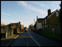
 Flimwell in East Sussex lies right on the Kent and Sussex borders,
where the A268 crosses the A21 London to Hastings road. Flimwell in East Sussex lies right on the Kent and Sussex borders,
where the A268 crosses the A21 London to Hastings road.
In 1264, King Henry III and his army stopped at
Flimwell on their way to the Battle of Lewes. During
an argument, he learnt that some local men, who
were siding with the Barons, had killed his cook.
In retribution, the Royal army gathered 300 local
people together in a field in the village, and
cut their heads off. This area is now know as
Yellowcoat wood, 300 people would have been most
of the population for a few miles.
More recently in 1944 a V1 doodlebug exploded near
the school, which was destroyed, the children being
sent to Ticehurst for their schooling. The old school
laid derelict until 1980, when it was converted into
a house.
From Flimwell crossroads, take the Hawkhurst road,
and just over the brow of the hill, on the right hand
side stands an outstanding group of houses, which
were part of a Victorian farm estate. They have steep
gables, Gothic windows, half timbering, and tile
hanging in the much older Sussex tradition.
Rising behind the cottages, on the brow of a hill,
is in contrast a sign of modern times - the lattice
tower and round receivers of a television relay and
transmitting tower.
The National Pinetum collection of pine trees, is
located on the Goudhurst road. It provides woodland
walks for many miles, as the forest spreads from
Flimwell to Hawkhurst in the east and towards Goudhurst
in the north.
Also a tributary of the Bewl Bridge resevoir, can be
seen if looking south west from the Dual Carriageway. |
|
 There are some nice views in the area. From the A21
cross roads, take the Hawkhurst road to the top of
the hill, and look East towards Hawkhurst . From the
same vantage point look north west towards Bewl Bridge
resevoir. There are some nice views in the area. From the A21
cross roads, take the Hawkhurst road to the top of
the hill, and look East towards Hawkhurst . From the
same vantage point look north west towards Bewl Bridge
resevoir.
If you drive up the dual carriageway towards London,
there is a picnic site to the left with views across
the resevoir.
However the scenery of the Bedgebury Pinetum area is spectacular,
this can be located about 2 miles from the village, on the
Goudhurst road, which is found in the center of the
dual carriageway. A few hours walking in this area
is very theraputic. |
|
 Most of the original village services at Flimwell in East Sussex,
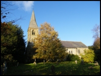
have now left, with the exception of the church. Most of the original village services at Flimwell in East Sussex,
have now left, with the exception of the church.
The small town of Hawkhurst 3 miles East provides
much of the simple requirements, with Tunbridge
Wells about 12 miles North West providing the
remaining goods.
The frequent Hawkhurst to Tunbridge Wells bus service
passes through the village East to West.
The nearest trains can be caught at the stations in
Etchingham about 4 miles south, or Stonegate , about
4 mile south west. |
|
| Flimwell is shown as the red symbol on the map. |
|
|
Nearby Villages
(click on symbol to see the village page) |
| Village= | |
Town= | |
Recorded in Domesday= |  |
| |
|
|
Bells Yew Green |
(The ruins of Bayham Abbey) | | 7.29 miles |
|
|
Benenden |
(One of Englands Top Girls Schools) | | 5.99 miles |
|
|
Bodiam |
(The finest ruined castle in the Country) | | 5.35 miles |
|
|
Burwash |
(The home of Rudyard Kipling) | | 4.62 miles |
|
|
Cranbrook |
(Christmas Cards and Union Mill) | | 4.91 miles |
|
|
Etchingham |
(The oldest Brass Weather Vane in the country) | | 3.18 miles |
|
|
Hawkhurst |
(A Notorious Gang of Smugglers) | | 2.82 miles |
|
|
Hurst Green |
(The Youngest Highwayman on record) | | 2.74 miles |
|
|
Kilndown |
(Charcoal for the Furnace) | | 2.71 miles |
|
|
Lamberhurst |
(Scotney Castle and Gardens) | | 3.96 miles |
|
|
Sandhurst |
(Escape from the Great Plague) | | 5.45 miles |
|
|
Sissinghurst |
(The magnificent garden of Vita Sackville-West) | | 6.26 miles |
|
|
Stonegate |
(Ancient Roman Cross Road) | | 3.36 miles |
|
|
Ticehurst |
(Anne Boleyn and Pashley Manor) | | 1.72 miles |
|
|
Wadhurst |
(Last bare fisted Prize-Fight in England) | | 4.74 miles |
|
|
| Copyright Villagenet 1998-2025 | |
| |
|
|
Local Interest
Just click an image |
|
|
|
|
|
|
|
|
|
|
|
|
|
|
| |