| |

|
|
|
| |
 11 miles east of Hastings on the A259, Rye in East Sussex sits on a hill
top with the church tower at the highest point, and the
buildings clustered all around. The town is situated a few
miles from the sea, however during the Middle Ages it stood
on a promontory. It was linked to the land by a narrow,
easily defensible neck of land, guarded on either side by
the wide estuaries of the Rivers Tillingham and Rother.
The Saxons called it 'Atter Ie', meaning 'on the island'.
Over the years this was altered to 'Atte Rie', and finally
to just Rye . 11 miles east of Hastings on the A259, Rye in East Sussex sits on a hill
top with the church tower at the highest point, and the
buildings clustered all around. The town is situated a few
miles from the sea, however during the Middle Ages it stood
on a promontory. It was linked to the land by a narrow,
easily defensible neck of land, guarded on either side by
the wide estuaries of the Rivers Tillingham and Rother.
The Saxons called it 'Atter Ie', meaning 'on the island'.
Over the years this was altered to 'Atte Rie', and finally
to just Rye .
During 1287 AD a severe storm hit the channel, and the movement of shingle
from Dungeness blocked the outlet of the Rother at New Romney , the river
changed its path to its current position to Rye. Due to this major piece
of good fortune the town was together with its neighbour Winchelsea
linked to the Cinque Ports as an 'Antient Town' in 1289 AD, and was responsible
for supplying ships to the English Fleet.
In the same year it was given the status of a Royal Borough.
In 1377 and 1448 the city was burned down by the French. From
the 15th Century, its importance declined, due to raids by the French,
and the silting up of the estuary and the build up of shingle
along the foreshore. However its fishing fleet remains important,
and still survives today - the boats unload their catches on
the quayside on the Eastern side of the town.
In 1539 the harbour was looked on as important by King Henry VIII and
the small defensive fort of Camber Castle was expanded to provide cover to
the harbour in the Camber(Chambre) between present Camber , East Guldeford ,
Rye and Winchelsea. The fort became obsolete by 1637 as the
Camber had silted so badly.
In 1573 Queen Elizabeth I visited Rye and was so pleased by
her reception that she gave the town the right to call itself
'Rye Royal'.
In 1726 George I was grounded on Camber Sands, and he stayed
at Rye for 4 days, at Lamb House, Rye's grandest town mansion.
It was built and owned by James Lamb, a member of the Lamb
family who ran the town throughout the 18th century. The
house has been the home to two famous writers. The American
novelist Henry James lived there from 1897 - 1916, and
E.F.Benson, who was also mayor of Rye in 1934.
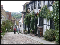
Mermaid Street is Rye's most photographed street. It is cobbled,
and lined with beautiful old houses. The Mermaid Inn, full of
beams and Inglenooks is said to have been founded in the 11th
century, and in the 'olden days' it was frequented by the
notorious and vicious Hawkhurst Gang of smugglers .
Parts of Rye still look today very much as they did in the
Middle Ages. It is one of the gems of the East Sussex coast,
and in summer is packed with tourists who come to admire its
half timbered Georgian houses, its cobbled streets and its
medieval fortifications. Its superb setting between the rolling
sussex countryside, and the levels of Romney Marsh with
the sea beyond stretching into the distance, makes for
some magnificent views.
This village is associated with the Sussex Bonfire Societies , who provide
noisy processions, unbelievable outfits and fantastic firework displays throughout
the month of November - a spectacle not to be missed. |
|
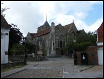
 There are many views in Rye in East Sussex , walk up to the church, and follow
Mermaid Street down to the Quay .
The old High Street is very enjoyable to walk down. There are many views in Rye in East Sussex , walk up to the church, and follow
Mermaid Street down to the Quay .
The old High Street is very enjoyable to walk down.
Walk down to the Landgate , and then look down on the Fishing Quay,
and the expanse of flat land across the Dungeness Marshes.
The most impressive view for those who like wide vistas, is probably
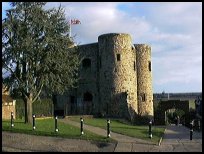
from the old Town Gaol (which now houses Rye Castle Museum), looking
out on the Marshes to the left, Camber in front and Fairlight to the right.
The 1066 Country Walk runs to the town. |
|
 Rye in East Sussex is the main shopping centre for many of the surrounding
villages. There are many small shops, and a supermarket in the
town, along with many gift shops, pubs and eating places. Rye in East Sussex is the main shopping centre for many of the surrounding
villages. There are many small shops, and a supermarket in the
town, along with many gift shops, pubs and eating places.
The Hastings to Folkestone hourly bus service travels through
the town, with less frequent services to Tenterden .
The town has its own railway station on the Ashford to Hastings
line, with an hourly service during the day, and more frequently
during rush hour. |
|
| Rye is shown as the red symbol on the map. |
|
|
Nearby Villages
(click on symbol to see the village page) |
| Village= | |
Town= | |
Recorded in Domesday= |  |
| |
|
|
Beckley |
(Alfred the Great and Guns !) | | 4.97 miles |
|
|
Brede |
(Edward I inspects the Channel Fleet) | | 6.20 miles |
|
|
Broad Oak Brede |
(On the Crossroads) | | 6.11 miles |
|
|
Brookland |
(13th century wooden spire) | | 5.50 miles |
|
|
Broomhill |
(Swept away by the Storm) | | 3.59 miles |
|
|
Camber |
(Sands and Holidays) | | 2.70 miles |
|
|
East Guldeford |
(Barn-like Church) | | 1.02 miles |
|
|
Fairfield |
(The Isolated Church) | | 4.68 miles |
|
|
Guestling |
(Changing guards at Buckingham Palace) | | 5.69 miles |
|
|
Icklesham |
(Paul McCartney's Recording Studio) | | 3.64 miles |
|
|
Iden |
(Sheriff of Kent and Jack Cade) | | 2.32 miles |
|
|
Northiam |
(Prime Ministers D Day inspection) | | 6.78 miles |
|
|
Old Winchelsea |
(Abandoned after the Great Storm) | | 1.84 miles |
|
|
Peasmarsh |
(Black Death moves village) | | 3.26 miles |
|
|
Pett |
(End of the Royal Military Canal) | | 4.96 miles |
|
|
Playden |
(Saltcote and fish) | | 1.71 miles |
|
|
Rye Harbour |
(Nature Reserve and unspoilt beaches) | | 1.35 miles |
|
|
Udimore |
(Angels move the Church) | | 3.87 miles |
|
|
Winchelsea |
(Inland Cinque Port !!) | | 2.11 miles |
|
|
Winchelsea Beach |
(Holidaymakers and Henry VIIIs Fort) | | 2.39 miles |
|
|
| Copyright Villagenet 1998-2025 | |
| |
|
|
Local Interest
Just click an image |
|
|
|
|
|
|
|
|
|
|
|
|
|
|
| |