| |

|
|
|
| |
 Brookland in Kent is a compact village which lies on Walland Marsh
about 12 miles South East of Tenterden on the A259. Brookland in Kent is a compact village which lies on Walland Marsh
about 12 miles South East of Tenterden on the A259.
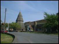
Its church is well known on account of the fact that it has a
detached wooden bell tower. The tower is octagonal, and has a
conical roof of three diminishing 'flounces'. Until 1936 it was
covered in black tarred weatherboarding. It is believed the tower
was built around 1260, and so is contemporary with the church
itself.
The church is dedicated to St Augustine, the first Archbishop of
Canterbury. On entering the church you will notice that the nave
arcades lean outwards at a perilous angle. This occurred many years
ago due to subsidence. There is still some settlement, and half an
inch has been recorded since 1900.
The Royal Arms of George II hang over the south door, and on the
south wall is a wall painting of Thomas a Beckett.
The chancel was restored in the 19th century, but the nave remains
untouched, and has a Georgian pulpit and box pews.
Much has been written about the famous circular lead font. It is
said to be the most important of the 30 leaden fonts remaining
in this country. It is thought to have been of Flemish or Norman
origin. It depicts the months and the signs of the zodiac. It is
unknown how or why this amazing font came to Brookland Church, but
it is possible that the font was raided from a French church during
the 100 Years War .
In the churchyard can be found a headstone adorned with an oval
terra cotta plaque depicting a basket of fruit and flowers. It is
inscribed 'HARMER FECIT'. Jonathan Harmer and his son were stonemasons
at Heathfield in East Sussex. They made these tombstone plaques in
the late 18th century using the local clay from Heathfield Park.
Other examples can be seen at Burwash , Wadhurst , Salehurst ,
Glynde , and in other sussex churchyards. This would appear to be the
only example that strayed across into Kent.
In February 1821 the Battle of Brookland took place between the
Customs and Excise men and the Aldington Gang of smugglers. The
smugglers had sent 250 men down to the coast between Camber and
Dungeness . The party was seen by the Watch House at Camber and
a fight took place over Walland Marsh, the outcome was that one
of the leaders of the gang Cephas Quested was captured. The
injured were treated by Dr Ralph Hougham who lived in Brookland
at Pear Tree House.
St Augustines at Brookland is one of those churches supported by the
Romney Marsh Historic Churches Trust . |
|
 Brookland in Kent is on Walland Marsh, and is very flat for miles around,
this gives the feeling of wide open spaces. Brookland in Kent is on Walland Marsh, and is very flat for miles around,
this gives the feeling of wide open spaces.
The church with its unusual spire its leaning walls and its
Harmer Terracotta gravestone is a pretty place to visit. |
|
 Brookland in Kent has a few local village services, but the nearest major
shopping area is at Ashford about 16 miles north east. The nearest
smaller town is Rye about 8 miles west.
The nearest train service is from Appledore about 5 miles north
west providing an hourly service to Hastings and Ashford . Brookland in Kent has a few local village services, but the nearest major
shopping area is at Ashford about 16 miles north east. The nearest
smaller town is Rye about 8 miles west.
The nearest train service is from Appledore about 5 miles north
west providing an hourly service to Hastings and Ashford . |
|
| Brookland is shown as the red symbol on the map. |
|
|
Nearby Villages
(click on symbol to see the village page) |
| Village= | |
Town= | |
Recorded in Domesday= |  |
| |
|
|
Appledore |
(Danes invade England) | | 3.08 miles |
|
|
Brenzett |
(St Eanswyth a saxon princess) | | 1.10 miles |
|
|
East Guldeford |
(Barn-like Church) | | 4.48 miles |
|
|
Fairfield |
(The Isolated Church) | | 1.69 miles |
|
|
Greatstone |
(Parabolic Sound Detectors and PLUTO) | | 6.16 miles |
|
|
Iden |
(Sheriff of Kent and Jack Cade) | | 4.72 miles |
|
|
Ivychurch |
(The burial ground on the Island) | | 2.51 miles |
|
|
Littlestone |
(The Genteel Resort) | | 5.62 miles |
|
|
Lydd |
(The Cathedral of the Marsh) | | 4.59 miles |
|
|
Lydd on Sea |
(Bungalows and Fishermen) | | 6.97 miles |
|
|
Newchurch |
(The Church Tower with a kink) | | 5.29 miles |
|
|
New Romney |
(Cinque Port and Storm) | | 4.67 miles |
|
|
Old Romney |
(Sheep and Wool Smuggling) | | 2.71 miles |
|
|
Playden |
(Saltcote and fish) | | 4.22 miles |
|
|
Rye |
(On the Island) | | 5.50 miles |
|
|
Smallhythe |
(The Ellen Terry Museum) | | 6.52 miles |
|
|
Snargate |
(Sluice Gates made by Royal Order) | | 1.58 miles |
|
|
Snave |
(the Remote church) | | 2.86 miles |
|
|
St Mary in the Marsh |
(Ancient Celts) | | 4.90 miles |
|
|
St Marys Bay |
(Holidays and Beaches) | | 6.32 miles |
|
|
Stone in Oxney |
(Roman stone altar) | | 3.35 miles |
|
|
Wittersham |
(Park your Airship here ?) | | 5.83 miles |
|
|
| Copyright Villagenet 1998-2025 | |
| |
|
|
Local Interest
Just click an image |
|
|
|
|
|
|
|
|
|
|
|
|
|
|
| |