| |

|
|
|
| |
 Burmarsh in Kent is a very small marshland village which lies just inland
from the A259 at Dymchurch between the coast and the hills at
Lympne .
During Roman times the area was used to provide salt for the Empire. Burmarsh in Kent is a very small marshland village which lies just inland
from the A259 at Dymchurch between the coast and the hills at
Lympne .
During Roman times the area was used to provide salt for the Empire.
The manor of Burmarsh was given to St Augustine's Priory at
Canterbury before the Norman Invasion in 1066.
The village has for centuries been involved with shepherding and wool
and of course smuggling , being only a mile or two inland from the coast.
On the 16th July 1927, the Romney Hythe and Dymchurch Railway (RHDR) a narrow gauge railway
was opened, a stop at Burmarsh Road was planned to be a full station. It had two
platforms , a ticket office and waiting room and signals. It was rarely
used and it was demolished in 1948. It became just a halt but even this
closed in 1949.
The railway was built by Captain J. E. P. Howey and Count Louis Zborowski to
serve the local population and tourist trade, it stretches for nearly 14 miles
from Hythe through Dymchurch , St Marys Bay ,its base at New Romney ,Romney Sands
and then to the fishermens cottages and lighthouses at Dungeness . It is still
a major tourist attraction and well worth a visit.
(Click here for the Official RHDR site)
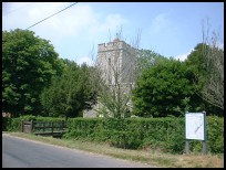
All Saints at Burmarsh is one of those churches supported by the
Romney Marsh Historic Churches Trust . |
|
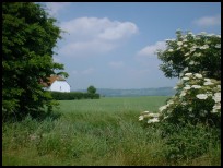
 Burmarsh in Kent lies in one of the flattest and most deserted parts of Southern
England, this provides safe push bike riding through the Romney Marsh . Burmarsh in Kent lies in one of the flattest and most deserted parts of Southern
England, this provides safe push bike riding through the Romney Marsh .
All through the area are drainage dykes , small bridges , wildlife and
peace and quiet, a nice place to be on warm Summer days. |
|
 Burmarsh in Kent only has a public house and the church for its local services. Burmarsh in Kent only has a public house and the church for its local services.
The nearest services are at nearby Dymchurch , with more shopping at
Hythe and Folkestone further to the east.
The nearest trains are the RH&DR narrow gauge railway at Dymchurch . |
|
| Burmarsh is shown as the red symbol on the map. |
|
|
Nearby Villages
(click on symbol to see the village page) |
| Village= | |
Town= | |
Recorded in Domesday= |  |
| |
|
|
Aldington |
(The Aldington Gang) | | 3.99 miles |
|
|
Bilsington |
(The Priory and Obelisk) | | 4.37 miles |
|
|
Bonnington |
(Saint Rumwold the child saint) | | 3.77 miles |
|
|
Brenzett |
(St Eanswyth a saxon princess) | | 6.92 miles |
|
|
Dymchurch |
(The Romans and the sea wall) | | 1.26 miles |
|
|
Hamstreet and Orlestone |
(The Start of the Ordnance Survey) | | 7.03 miles |
|
|
Ivychurch |
(The burial ground on the Island) | | 5.47 miles |
|
|
Lympne |
(From Roman Castle to Tigers) | | 2.23 miles |
|
|
Newchurch |
(The Church Tower with a kink) | | 3.04 miles |
|
|
Old Romney |
(Sheep and Wool Smuggling) | | 6.07 miles |
|
|
Ruckinge |
(Smuggling and Traction Engines) | | 5.08 miles |
|
|
Sellindge |
(Oliver Cromwells Horse) | | 4.01 miles |
|
|
Snave |
(the Remote church) | | 5.81 miles |
|
|
St Mary in the Marsh |
(Ancient Celts) | | 3.40 miles |
|
|
St Marys Bay |
(Holidays and Beaches) | | 2.85 miles |
|
|
| Copyright Villagenet 1998-2025 | |
| |
|
|
Local Interest
Just click an image |
|
|
|
|
|
|
|
|
|
|
|
|
|
|
| |