| |

|
|
|
| |
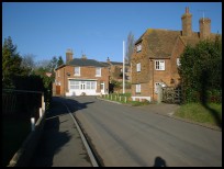
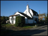
 Ruckinge in Kent is a small village which lies on the northern edge of the
Romney Marsh .
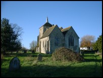
The village was founded in Saxon times as can be seen from parts
of the church, most of the remainder is Norman . Ruckinge in Kent is a small village which lies on the northern edge of the
Romney Marsh .
The village was founded in Saxon times as can be seen from parts
of the church, most of the remainder is Norman .
It would seem that the Ransleys were not quite the law abiding
citizens that they could have been. The churchyard contains a
simple grave of three iron supports and a plank to mark the grave
of two brothers from the Ransley family who were convicted of
highway robbery in 1800. They were hung on nearby Penenden Heath ,
and their remains buried in the churchyard.
In 1792 George Ransley was born at Ruckinge , and started work as
a ploughman then a carter. The story goes that he found a stash
of spirits hidden by the smugglers and with the proceeds of the sale
bought his house the Bourne Tap. Ransley took over the Aldington
gang of smugglers after the Battle of Brookland in 1820. The gang
became stronger and landed goods all along the coast from Rye to
Deal . In July 1826 they were caught on the beach at Dover and a
Midshipman Richard Morgan was killed. In October 1826 Ransley was
arrested at Aldington by the Bow Street Runners on suspicion of
murder, but as it took place in the dark, the death sentence was
converted to deportation. Ransley was sent to work on a farm in
Tasmania.
In 1804 Napoleon was getting ready to invade England, the government
decided to try to stop a French invasion via the Romney Marshes and
they built the Royal Military Canal as part of the nations defenses.
It was re-fortified in the 1940's by installing gun emplacements and
pill boxes to try to delay a German invasion via the Marshes, the
canal runs alongside Ruckinge .
Ruckinge also housed Thomas Aveling, who was one of the pioneers
of the Traction Engine in the mid 1800s. |
|
 Ruckinge in Kent is just above the level of the Romney Marsh , and has fine
views across the vast landscape. Ruckinge in Kent is just above the level of the Romney Marsh , and has fine
views across the vast landscape.
The Royal Military Canal runs along the southern edge of the village
and is popular with walkers and fishermen. |
|
 The village is quite small, with few services. The village is quite small, with few services.
Trains can be caught at Hamstreet about 2 miles east, and the major
shopping in the area is to be found at Ashford about 6 miles north,
where the main London trains can be found. |
|
| Ruckinge is shown as the red symbol on the map. |
|
|
Nearby Villages
(click on symbol to see the village page) |
| Village= | |
Town= | |
Recorded in Domesday= |  |
| |
|
|
Aldington |
(The Aldington Gang) | | 3.05 miles |
|
|
Appledore |
(Danes invade England) | | 4.95 miles |
|
|
Bilsington |
(The Priory and Obelisk) | | 1.12 miles |
|
|
Bonnington |
(Saint Rumwold the child saint) | | 2.11 miles |
|
|
Brenzett |
(St Eanswyth a saxon princess) | | 4.15 miles |
|
|
Burmarsh |
(The fortress in the Marsh?) | | 5.08 miles |
|
|
Dymchurch |
(The Romans and the sea wall) | | 5.44 miles |
|
|
Hamstreet and Orlestone |
(The Start of the Ordnance Survey) | | 1.97 miles |
|
|
Ivychurch |
(The burial ground on the Island) | | 3.67 miles |
|
|
Kenardington |
(Danes destroy Saxon Fort) | | 3.38 miles |
|
|
Lympne |
(From Roman Castle to Tigers) | | 6.03 miles |
|
|
Mersham |
(Founder of Ashford Grammar School) | | 4.21 miles |
|
|
Newchurch |
(The Church Tower with a kink) | | 2.35 miles |
|
|
Sellindge |
(Oliver Cromwells Horse) | | 5.89 miles |
|
|
Smeeth |
(The Scott Family) | | 4.88 miles |
|
|
Snargate |
(Sluice Gates made by Royal Order) | | 3.71 miles |
|
|
Snave |
(the Remote church) | | 2.33 miles |
|
|
St Mary in the Marsh |
(Ancient Celts) | | 4.41 miles |
|
|
St Marys Bay |
(Holidays and Beaches) | | 5.60 miles |
|
|
Stone in Oxney |
(Roman stone altar) | | 6.40 miles |
|
|
Warehorne |
(A good place to explore the Marshes) | | 2.24 miles |
|
|
Woodchurch |
(Dragoons capture Smugglers) | | 4.92 miles |
|
|
| Copyright Villagenet 1998-2025 | |
| |
|
|
Local Interest
Just click an image |
|
|
|
|
|
|
|
|
|
|
|
|
|
|
| |