| |

|
|
|
| |
 10 miles south east of Tenterden on the B2080 in the heart of the
Romney Marsh lies Snargate in Kent . 10 miles south east of Tenterden on the B2080 in the heart of the
Romney Marsh lies Snargate in Kent .
The name of the village has varied over the years from Snergathe to
Snergate, and can be traced back to the snare-gate or sluice gates
erected here. They were essential in the maintenance of a water-way
to the harbour at Romney.
In 1254 during Henry III reign it was directed by Royal order, that
a new sluice gate should be made. In 1401 the Jurats of Romney paid
£16 10s 9d for the making of a new gate.
The list of Knights Fees in Kent mentions the manor of 'Snergate'.
Admiral Gervase Alard held the manor in 1306, and paid 1/4 of a
knights fee. In 1347 when Edward the Black Prince was made a
knight, Dionisia Alard paid 1/8th of a fee for the Manor. The
famous historian, Halsted, says that in 1369 Agnes Alard, widow,
died in posession of this property. There is no other mention of
posession of the manor until 1461, when it passed to John Fare of
Tonbridge.
Late in the 18th century, the row of cottages in front of the church
were used as a workhouse for the poor. The church records show an
old bill of 6s 6d paid to Miss Smith for nursing the smallpox
victims of the workhouse for three nights, three days and a half.
In 1821 the parish held 15 dwellings and a total population of 93
people.
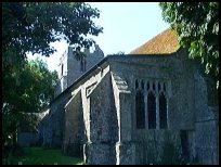
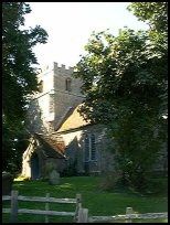
The parish church is dedicated to St Dunstan, and stands on a man
made mound, surrounded by trees. A surprisingly large building, it was
erected around 1200 in the Early English style. The interest of the
interior was diminished somewhat by the considerable restorations
carried out by the Reverend Edward Wilkinson in 1871.
On the north side of the nave stands the font, which has a square
bowl and stem. It dates from about 1220, and still retains its original
lead lining. It has a flat oak lid which probably dates from the 16th
century.
A peculiar feature of this, and other churches in the district, is the
lack of a chancel arch.
On the south side of the altar in the east wall lies a 14th century
piscina, which fell victim to the Victorian restoration.
The sanctuary rails, made of oak with lovely wrought iron supports
are believed to date from the 14th century.
A finely carved Late Stuart chair, made around 1685 can be seen on
the north side of the chancel. It is still used by the Bishop
officiating at Confirmation Services and other functions.
Opposite the main door, on the north wall is a terracotta coloured
painting of a ship of around the year 1500. About 5ft by 4ft the
painting was hidden under a layer of whitewash, and was uncovered
a few years ago when work was being done on the church. Mrs Baker
an authority on mural painting, considered it to be a 16th century
work. Her assistant, Mr David Perry, later cleaned and restored it.
The big house behind the church used to be the Rectory. Due to the
difficulty of finding a clergyman for every parish the house was
sold to a Mr H Clarke in 1918.
St Dunstan at Snargate is one of those churches supported by the
Romney Marsh Historic Churches Trust . |
|
 If you park by the church and walk down the lane, the rich farmlands can
be seen all around. Watch out for sheep, as there are many in this area. If you park by the church and walk down the lane, the rich farmlands can
be seen all around. Watch out for sheep, as there are many in this area.
A walk around the church is quite relaxing, and there is always the local
public house to stop at. |
|
 Snargate in Kent's local services are limited, and New Romney about 4 miles
south provides local services.
The nearest train runs from Appledore station on the Hastings to
Ashford line, which runs hourly services across the Romney Marsh . Snargate in Kent's local services are limited, and New Romney about 4 miles
south provides local services.
The nearest train runs from Appledore station on the Hastings to
Ashford line, which runs hourly services across the Romney Marsh . |
|
| Snargate is shown as the red symbol on the map. |
|
|
Nearby Villages
(click on symbol to see the village page) |
| Village= | |
Town= | |
Recorded in Domesday= |  |
| |
|
|
Appledore |
(Danes invade England) | | 2.34 miles |
|
|
Bilsington |
(The Priory and Obelisk) | | 4.76 miles |
|
|
Bonnington |
(Saint Rumwold the child saint) | | 5.66 miles |
|
|
Brenzett |
(St Eanswyth a saxon princess) | | 1.06 miles |
|
|
Brookland |
(13th century wooden spire) | | 1.58 miles |
|
|
Fairfield |
(The Isolated Church) | | 2.16 miles |
|
|
Hamstreet and Orlestone |
(The Start of the Ordnance Survey) | | 3.84 miles |
|
|
Iden |
(Sheriff of Kent and Jack Cade) | | 5.49 miles |
|
|
Ivychurch |
(The burial ground on the Island) | | 2.24 miles |
|
|
Kenardington |
(Danes destroy Saxon Fort) | | 2.87 miles |
|
|
Littlestone |
(The Genteel Resort) | | 5.96 miles |
|
|
Newchurch |
(The Church Tower with a kink) | | 4.34 miles |
|
|
New Romney |
(Cinque Port and Storm) | | 5.07 miles |
|
|
Old Romney |
(Sheep and Wool Smuggling) | | 3.29 miles |
|
|
Playden |
(Saltcote and fish) | | 5.23 miles |
|
|
Ruckinge |
(Smuggling and Traction Engines) | | 3.71 miles |
|
|
Smallhythe |
(The Ellen Terry Museum) | | 6.22 miles |
|
|
Snave |
(the Remote church) | | 1.58 miles |
|
|
St Mary in the Marsh |
(Ancient Celts) | | 4.67 miles |
|
|
St Marys Bay |
(Holidays and Beaches) | | 6.18 miles |
|
|
Stone in Oxney |
(Roman stone altar) | | 3.31 miles |
|
|
Tenterden |
(Centre of the Broadcloth industry) | | 7.34 miles |
|
|
Warehorne |
(A good place to explore the Marshes) | | 2.50 miles |
|
|
Wittersham |
(Park your Airship here ?) | | 5.99 miles |
|
|
Woodchurch |
(Dragoons capture Smugglers) | | 4.47 miles |
|
|
| Copyright Villagenet 1998-2025 | |
| |
|
|
Local Interest
Just click an image |
|
|
|
|
|
|
|
|
|
|
|
|
|
|
| |