| |

|
|
|
| |
 11 miles south east of Tenterden, off the B2082, Stone in Oxney in Kent stands
in an imposing position on the eastern side of the Isle of Oxney. The
stone that gives the village its name is preserved in the village
church, and is Roman in origin. 11 miles south east of Tenterden, off the B2082, Stone in Oxney in Kent stands
in an imposing position on the eastern side of the Isle of Oxney. The
stone that gives the village its name is preserved in the village
church, and is Roman in origin.
The church of St Mary is 15th century, an elegant building which stands
on rising ground. It features a 14 ft square tower, which stands 62 ft
high. Magnificent views over the surrounding countryside may be seen
from the top of the tower.
The oldest part of the church is the South Chapel, here may be found
the sealed up entrance to the staircase which used to lead to the
rood loft.
The font stands at the western end of the nave, octagonal in shape,
with no ornamentation, it is a picture of elegant simplicity.
For many years the north chapel was used as the parish school. The
south chapel houses the organ a two manual instrument in an oak case.
this organ was formerly used by the parish church of Brede , and was
aquired for Stone in 1908.
The most interesting posession of the church is the aforementioned
Roman Stone. Standing under the tower, near the west door, it serves
as an altar. It is 2ft long by 1ft 10ins, and stands 3ft 4ins high.
The top is hollowed out as a basin, and the figure of a bull stands
in relief on all four sides. Geological experts say it is made of
Kentish ragstone, quarried aat Hythe. The altar may have originally
come from Stutfall Castle, the Roman fort at Lympne, near Hythe.
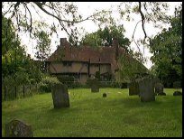
To the south west of the church stands a picturesque 15th century
building called 'Tilmanden'. For many generations this served as
the vicarage, and was probably built for this purpose. However a
new vicarage of red brick was erected on the other side of the
road, this date is not recorded. This building burned down several
years before the Reverend H.P.Eldridge became the incumbent in 1862,
and the present vicarage was built soon after. |
|
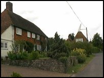
 The area around the church is very pretty, with the churchyard and the
old house of Tilmanden. The area around the church is very pretty, with the churchyard and the
old house of Tilmanden.
Over the road from the church is another National Trust area, which overlooks
the Romney Marsh . |
|
 Stone In Oxney in Kent is a very small village with few local services. Stone In Oxney in Kent is a very small village with few local services.
The nearest shopping centres are in Tenterden to the north and Rye to the
west. |
|
| Stone In Oxney is shown as the red symbol on the map. |
|
|
Nearby Villages
(click on symbol to see the village page) |
| Village= | |
Town= | |
Recorded in Domesday= |  |
| |
|
|
Appledore |
(Danes invade England) | | 1.50 miles |
|
|
Beckley |
(Alfred the Great and Guns !) | | 5.86 miles |
|
|
Bilsington |
(The Priory and Obelisk) | | 7.52 miles |
|
|
Brenzett |
(St Eanswyth a saxon princess) | | 3.97 miles |
|
|
Brookland |
(13th century wooden spire) | | 3.35 miles |
|
|
Fairfield |
(The Isolated Church) | | 1.69 miles |
|
|
Iden |
(Sheriff of Kent and Jack Cade) | | 2.80 miles |
|
|
Ivychurch |
(The burial ground on the Island) | | 5.46 miles |
|
|
Kenardington |
(Danes destroy Saxon Fort) | | 3.61 miles |
|
|
Newenden |
(Alfred the Great's Fort) | | 6.55 miles |
|
|
Old Romney |
(Sheep and Wool Smuggling) | | 6.04 miles |
|
|
Peasmarsh |
(Black Death moves village) | | 4.63 miles |
|
|
Playden |
(Saltcote and fish) | | 3.12 miles |
|
|
Rolvenden |
(Witches stealing Holy Water) | | 6.28 miles |
|
|
Ruckinge |
(Smuggling and Traction Engines) | | 6.40 miles |
|
|
Smallhythe |
(The Ellen Terry Museum) | | 3.17 miles |
|
|
Snargate |
(Sluice Gates made by Royal Order) | | 3.31 miles |
|
|
Snave |
(the Remote church) | | 4.77 miles |
|
|
Tenterden |
(Centre of the Broadcloth industry) | | 4.88 miles |
|
|
Warehorne |
(A good place to explore the Marshes) | | 4.33 miles |
|
|
Wittersham |
(Park your Airship here ?) | | 2.68 miles |
|
|
Woodchurch |
(Dragoons capture Smugglers) | | 3.91 miles |
|
|
| Copyright Villagenet 1998-2025 | |
| |
|
|
Local Interest
Just click an image |
|
|
|
|
|
|
|
|
|
|
|
|
|
|
| |